Planning, Design & Construction
Planning, Design & Construction
Planning, Design & Construction is a team of talented professionals ready to assist with your project needs. Our team is committed to meeting your project requirements with precision and expertise. Whether you are embarking on a new construction endeavor or seeking to revitalize existing spaces through renovations, our goal is to deliver premier service, ensuring projects are completed on time and within budgetary limits.
Our Team explores future additions to campus and champions our Long-Range Framework Plan. Design & Construction focuses on new capital construction and renovations to campus. Our Space Management group assists customers in taking full advantage of existing spaces.

Lasting Impacts
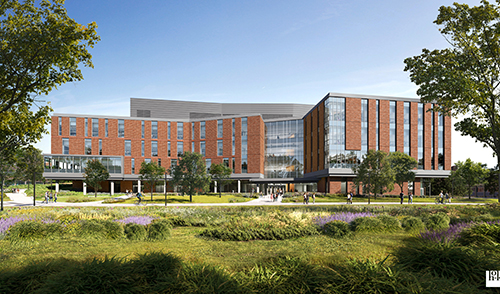
The Advanced Materials Innovation Complex (AMIC) is a proposed new building that establishes Clemson University as a serious R-1 institution in support of the Clemson Elevate strategic plan. It will be the University’s most technologically advanced facility.
CU Facilities, Planning, Design, and Construction transform lives by delivering exceptional projects and aim to be recognized for research, education, and scholarship that make a global impact.

“I value the collaboration and exchange of ideas among our PDC teams. We address common challenges and support one another by sharing diverse approaches and effective solutions.”
Stephanie CooperExecutive Director

